Doris: Lobster mapping
Posted Dec. 4, 2012 by Dave GriffithsDoris is a new project that has emerged from the development of Borrowed Scenery's Zizim app, repurposed into a scientific research tool in collaboration with the College of Life and Environmental Sciences at Exeter University and Helsinki University. Doris – named after the sea nymph in Greek mythology – will be used for mapping lobster catches on fishing boats so researchers working at the National Lobster Hatchery in Padstow can easily build up a picture of how the condition of the lobsters relates to their location, sea conditions and tide.
Here is an initial plan for how the thing will work:
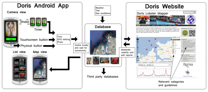
The main complexities include locating open data sources for sea conditions and tides and creating an interface that works easily enough on a small fishing boat under a variety of weather conditions – for example, touch screens aren't much use if you're wearing gloves. Approaches to try include using physical buttons, shaking the device, or voice input. As with previous FoAM projects Boskoi and Zizim, this will be built on the Ushahidi platform. Source repo location to follow…
Created: 15 Jul 2021 / Updated: 15 Jul 2021

